Tuesday, September 2, 2014

String and Leigh Lakes

We launched at String Lake mid-morning in calm clear waters under the stunning peaks of the Tetons.  The Grand Tetons are teenagers in mountain years still rising a couple inches per year.  String lake forms a connector between Jenny and Leigh Lakes with all three lying at the base of the mountains.  String is very shallow mostly between 1 -3 feet deep. Most of the tracks on the bottom were made by moose and I suspect an evening paddle would be an opportune time to see moose feeding.

String Lake Below Teton Peaks
Mid Teton, Grand Teton, and South Teton Reflected
So Clear and Shallow
Sun's Reflection in Wake Lines
End of the 1/4-mile Portage to Leigh Lake


String Lake is pond size at the launch and stream width for the remaining mile north to the 1/4-mile portage to Leigh Lake.  The trail is well marked and suitable for my kayak wheels that of course were back in the RV.  Back into our kayaks, we heard a Bull Elk bugling nearby....tis the season.  Around each point, the views were spectacular.  We came upon a campsite with 3 canoes on a sandy shoreline, 3 tents, and 5 chairs.  The campers were here on the lake for 4 nights and made their reservations in January.

Mt Moran with Active Glacier Doubled
First of Several Campsites on Leigh Lake
Leigh Lake is L-shaped with 1-mile to the point and 2.5 more miles west to the base of Mt Moran.  Rounding that point, 12,605-foot Mt Moran fills the view.  At the peak is a vertical strip of black magma that disappears under the active glacier then reappears below. In another campsite at the western shore, we sat on a log and finished left over pizza from Leeks.  Still excellent.

Rounding the Point 
U Shaped Canyons Carved by Glaciers
Mountains Come Down to the Lake
So Blue
Rock Slide from Active Glacier
Rock Posing 
Lunch Spot at Another Campsite


I liked the submerged tree Sheila got a photo of as we were starting out again.  Along the shore, I saw moose prints more than 10 feet under water.  At one of the visitors centers, we read that moose can swim and forage on plants with their entire bodies submerged.  There was a gentle down slope breeze as we headed back helping our progress.  Once around the point it was barely a factor.  Back at the portage, the toughest part was getting up over the stairs.  We took one loaded kayak to the top, talked with some folks that had walked up the trail, then returned for the second.  From there the portage was downhill and seemed much easier than the other direction.

Submerged
Heading Back
Back into String Lake after an Easier Downhill Portage


The surface of String Lake was now rippled, but it was easy to see the channels with enough water to navigate.  Scaling the park map, I figure we paddled 9 miles and portaged 1/2 mile round trip.  What a great paddle.

Beam Me Up


Monday, September 1, 2014

To Moose, Wyoming

We went back over to the lodge this morning to try and Skype with Aaron and Titina, still with no luck. We are missing seeing the grandchildren. The clouds were lower this morning beside the mountains with the snow sprinkled tops showing over the clouds. Except for right near the mountains, the sky was clear and bright blue. It was forty-eight degrees at 10:00 when we started out for the day, driving the eastern road of the John D. Rockefeller, Jr. Memorial Parkway.


We missed the Pacific Creek Road so went first to the river access where we walked down on the shore. We watched a couple of boats with fishermen and one float boat before returning to the Pacific Creek Road, a side road following a creek through sagebrush fields. 


Another dirt side road took us to Two Ocean Lake. We walked down by the lake to see if it would be a good place to kayak. The lake was fairly small, though pretty but we would have had to walk through several feet of goose poop in order to launch so decided against it. On these back roads, we really noticed that fall was in the air. The fall colors were starting to show, the wildflowers have all gone to seed except of a few remaining thistle blossoms and the Canada geese were flying high probably heading south.


Road on the Way to Two Ocean Lake
Two Ocean Lake
The Trees are Starting to Turn
Thistle, the Last of the Wildflowers
Geese Flying South


We saw twelve plus pronghorn shortly after going through the Moran Junction entrance and many more at Elk Ranch Flats Turnout. This area that is a huge, wide expanse of flat sagebrush covered land also has a small herd of bison. 

There are Bison Out There

Many ranchers and homesteaders tried to settle on this land but only a few survived the harsh conditions. We stopped at the Cunningham Cabin Historic Site where an original log home still exists. There was a self guiding tour map to the Flying Bar U Ranch that we tried to follow to find the locations of where other buildings were but lost sight of the paths and wound up wandering through the sagebrush looking for signs of the trail. We did find several narrow, hand-dug irrigation ditches that still had water flowing through them. Thankfully, the land is so flat we had no chance of getting lost.


The Flying Bar U

What a View!
Wandering the Sagebrush

Hard to Get Lost in These Expanses
The road down to Deadman's Bar on the Snake Rive had a nineteen percent grade, probably the steepest road we have ever driven on. The steep parts were paved but the rest was dirt. There were vehicles and trailers from all kinds of outfitters there and several groups getting ready to float the river. Signs warned of the danger of the river and only experienced guides should attempt it. We walked out on the sand bar and watched the rafts and fishing boats for awhile before moving on.

Looking Up River
And They Are Off
The next stop was the Snake River Overlook where Ansel Adams took one of his most famous photos. We stopped to take photos from the same spot that he did and are sure ours are just as good. Huh! Actually, the trees have grown up a lot more so the river is almost out of sight and our cameras take in a much wider view so they really aren't comparable. In any case, it is a spectacular view.


Ansel Adams' Photo
 Mine
And Ted's
At the Glacier View Turnout we got a good view of the glaciers on Grand, Middle and South Teton Mountains. We learned that in the past forty years the glaciers have lost twenty-five percent of their total surface area a fact we have found throughout the Rockies this summer.


Mormons settled the lower region of what is now Grand Teton National Park. The Antelope Flats Road leads to and area now called Mormon Row where there are many homes, barns, outbuildings and even outhouses still standing.


After a few photos we continued to the Craig Thomas Discovery and Visitor Center. This visitor center, built in 2007, had great exhibits as well as one of the best films we have seen in a national park. There were panels in the floor that showed films as well of scenes from around the park.


New Visitors Center


Bronze Moose, The Only Moose We Have Seen
Quilt of Native Wildlife by Local Quilt Guild

On to Menors Ferry Historic District, another Mormon settlement on the Snake River where we visited the General Store which had a mixture of old and new items on the shelves. We chatted with the man working there, a full-timer like us, who said he would tell us all about the free and inexpensive places to stay in Arizona. It turns out most of them were casinos and you had to gamble in order to stay there. No thanks. There is a replica of the ferryboat that crossed the river as well as the home of Maud Noble where the first meeting proposing a national park took place. 


General Store
Antler Chair in General Store
I Didn't Realize They Had Solar Panels Back Then


Maud Noble's Cabin


After spending time in the historic district, we were tired so stopped at a couple of turnouts and continued home.


It is Difficult Not to Keep Taking Photos of This

Sunday, August 31, 2014

Rainy Day

It was still pouring when I woke up this morning. Ted had already gone over to the lodge to use their internet. I put in another movie and sewed until about noon when we went back over to the lodge. The weather hasn't been cooperating but we will stay a few more days so we will have a chance to kayak and see some of the sights we haven't yet seen.


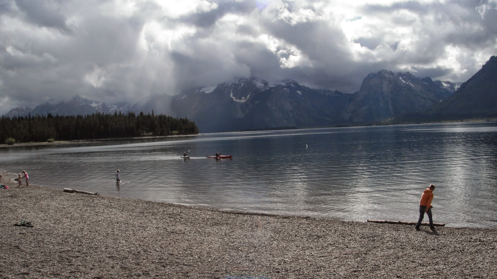
Late afternoon, it cleared some so we took a drive up to Colter Bay. After taking a few photos we went to the visitors center where they have a great Indian arts collection by David Vernon. We walked down by the shore where the beach was small, rounded, colored rocks that moved under our feet and were hard to walk on. Jackson Lake was mostly calm and the clouds had lifted to almost the tops of the mountains. It is a beautiful area and we would like to paddle to all the islands out there.

Grand Teton Lodge Company Bus Still in Use

Colter Bay
Islands to Explore


We were hungry so went to the restaurant for pizza and beer. Despite the $42, it was one of the best pizzas and craft beer we have had in a long time.

Saturday, August 30, 2014

Signal Mountain Road

It was a gray, overcast day so we decided to go to the lodge and work on out blog. We stayed until a little after noon and caught up on computer stuff. In the afternoon, I sewed and watched a movie while Ted read in the bedroom.

After dinner, it wasn't raining so we decided to take the five mile drive up signal mountain.  On our way up the narrow, winding mountain road, there were cars parked in the middle of the road with their doors open blocking the road. When they finally got back to their cars they said that they had seen the largest mule deer they had ever seen and were really excited about how big it was. On our way back down there were still cars there, again talking about the huge mule deer. I took one look and knew it was an elk. I wonder what stories they will have to tell when they show their photos to people.

At the top of the mountain, the parking lot faces the fields away from the Tetons and the lake. We stood there with our binoculars and could see over twenty-five elk down in the sagebrush fields. We could hear the sandhill cranes but weren't able to pick them out at that distance. It was still pretty overcast and when we stopped and walked to the Jackson Lake Overlook, it was like someone had taken the mountains away. They were totally obliterated by clouds. We got back to the motorhome about eight just in time for the rain to start and it rained pretty much all night.