Sunday, September 14, 2014

Archview Resort, North of Moab, UT

When Ted got up this morning he dug out the manual for the generator and found that there is a switch for high altitudes. We now suspect that it was the generator and not the transfer switch that was giving us the problem. There are so many details to this machine we are driving down the road.

One last view of Deer Creek from the Dump Station
Sunday is a good day to drive in Utah. As we drove south from Heber City through Provo and on to Spanish Fork there was virtually no traffic. All the Mormons were in church and the churchyards we passed were all full of cars. This whole area, much of which is urban is flat valley with really high mountains rising in the east.


Streets Clear on Sunday Morning

The Great Pumpkin Is in Utah
Windmills as We Approached US 6


South of Spanish Fork we got on US 6 which took us down to a short ride on I-70 and then twenty-nine miles to Moab. I'm not going to describe the incredible scenery that we went through but am adding random photos that I took along the way to show the beauty and variety of terrain that we covered today.


Cement Added Between Layers

Approaching the Gates
We are camped for the next five nights in Archview Resort (campground) almost across from one of the entrances to Canyonlands National Park and within sight across the plains and buttes of Arches National Park. It is a land of amazing red rocks that we visited nineteen years ago this summer and are looking forward to exploring again.


Church at Archview CG

Sunset on Arches NP
Interesting Concept

French Product

Saturday, September 13, 2014

Timpanogos Cave National Monument

We left mid-morning to go to Timpanogos Cave National Monument, the last national park or monument that we have not visited in Utah. We drove down the winding steep Heber Canyon to the other side of the Wasatch Mountain Range and up to American Fork where we headed back east on US 92 to the national monument. The film about the caves was just starting so we sat and watched it. There are three caves, Hansen, Timpanogos and Middle that were discovered in 1887, 1915 and 1921 respectively. They now have tunnels connecting them. The paved trail to the caves is a mile and a half long and rises more than a thousand vertical feet. They allow you an hour and a half to climb up to the caves with an hour tour and however long it takes you to get back down with a total average time of three hours. Unfortunately, due to lack of internet we had not done our homework. They only allow twenty people per tour and all the slots were reserved for the rest of the day and the next day so we didn't get to go through the caves.


Heber Canyon

Mt. Timpanogos in Background
Heading East From American Fork

Timpanogos Canyon Road
We Are at the Southern Point on Deer Creek Res


We did, however, continue on US 92 up through the Uinta National Forest which is a very narrow, winding road with lots of curves and switchbacks that continues for a total of twenty miles reaching an altitude of 8,060 feet before starting down the other side and back to US 189 where we were camped. Even at the highest point on the road, the Timpanogos Peak towered almost four thousand feet above us. The ride was spectacular with beautiful fall foliage. Many of the trees we discovered were some kind of maple. There were sections with the largest aspens we have ever seen which had not even begun to change to their gorgeous fall yellows. Tall mountains, deep valleys, bright colors, dark greens, gurgling brooks, sharp corners...we had it all. Most of the road was barely wide enough for two cars to meet and the going was slow but worth the time it took.


Aspen Lane


Fall Colors


Maple Leaves

Once out of the Uinta National Forest, we were in Aspen Grove where there is a huge BYU (Brigham Young University) Alumni Camp as well as the Sundance Ski Area. The roads improved and before long we were back on busy US 189. Back at the campsite, we had planned to go kayaking. After a late lunch, we changed our minds and settled in looking at the view of the many big powerboats on the water that would have made for a rough ride in small boats.


Sundance Ski Area

Northbound to Deer Creek
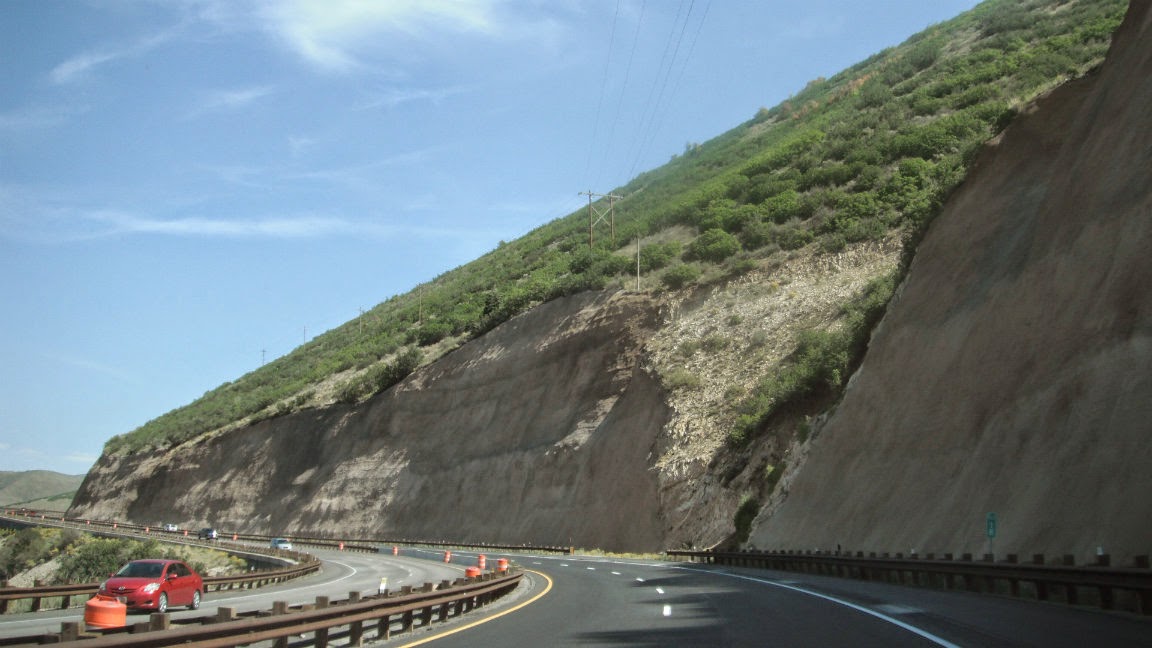
Gunnite Sprayed to Keep Rocks from Falling


I finished the hand sewing on my quilting project while Ted read with his eyes closed. Luckily all the bird dropping missed my handiwork and when it was time for happy hour, I moved my chair. After dinner the people across from us had  nice campfire which we enjoyed from our site.

Note: For future reference, the transfer switch that almost caused the motorhome to burn up last November started giving us problems again. No more using the generator until we get it checked out.

Friday, September 12, 2014

Deer Creek Reservoir

For some strange reason we decided not to turn the heat on last night. We were toasty warm under our Polartec blanket and down comforter but it was a shock when the interior of the coach was only forty-one degrees when we got up. It was twenty-seven outside and the car and kayaks had a thick layer of frost on them. The lake was covered in sea smoke and the sunrise through the mist was beautiful. Ted boiled water for coffee and tea and after a quick wash, we were on the road by 7:30. We had on winter hats and gloves to hook up the car. Guess we are not far enough south yet.


Once we were on the road, we could see for miles and miles in every direction with not a tree in sight. Yesterday and today we kept seeing signs that said "Road Closed When Blinking". Today there were also snow fences everywhere. With no trees to block the wind, they must have blizzard conditions whenever it snows. 


As we approached Kemmerer, a fairly large town by Wyoming standards, we could see a huge plume of white smoke beyond the town. Due to the hills, lack of trees and clear air, you can see a town when it is still more than ten miles away. We stopped at a Maverik gas station to pick up something for breakfast and then drove up out of town. Sadly, the frost last night had killed all the big hanging flower baskets that lined the streets. When we reached the top of the hill beyond town, there was some kind of mill and a strip mining operation in front of us. The company name was Elkol and the little town where it was located was called Diamondville. I wonder what they were mining?!?


We saw quite a few pronghorn in the fields before we reached I-80 a little after nine. Once into Utah, the beautiful red rocks started showing up almost immediately. The mountains near Park City including the ski mountain, Alta, had some kind of rust colored foliage all over them. Mixed with the dark greens, they were beautiful and so different from what we had seen. The town of Heber City was celebration its 125th anniversary and all the old fashioned lampposts in town had flags flying from them. It was quite a sight. We stopped at the Walmart on the outskirts of town for groceries and then started around Deer Creek Reservoir. It is the second reservoir we have passed in Utah today and both were very low.


When we got to the south end of the reservoir, we stopped at the Deer Creek State Park Campground. We paid for two nights and as we were driving in to our assigned campsite, we heard a terrible noise like we had hit something. I jumped out to look and couldn't see anything. Ted got out, looked up and could see that we were tangled up in branches overhead. We unhooked the car and while Ted unhooked the step ladder to climb up on top to see what damage might have been done, I drove back to the entrance gate to report what had happened and see if we could change sites. The guy (Rocky) at the gate called the maintenance supervisor and I returned to find Ted on the roof cutting branches of the thorny Russian olive tree. The assistant manager and maintenance manager showed up and authorized Ted to keep cutting until he had freed us from the tangle of branches, both dead and alive. We told them we were Florida State Park volunteers and once we moved and they had finished taking down limbs from the trees in that site, we chatted with the maintenance manager for over an hour with the assistant manager in on part of the conversation. It seems they have had problems with volunteers stealing gas and tools and not doing the job they were hired to do. I think if we wanted to work here, we would have no problem getting in.


We walked the paths along the bluff looking out at the high hills and big body of water and checked out the huge boat ramp before dinner and settling in for the evening. Unfortunately, neither of us took our cameras as it is really a beautiful location.  Ted did get a couple photos with his phone.


Thursday, September 11, 2014

Fontenelle Reservoir

We woke up to a cloudy, overcast morning, a good time to be moving on. While Ted was dumping the tanks and adding fresh water, it was spitting snow. After two weeks in Grand Teton National Park, we stopped at the post office in Moose and then headed toward Jackson. Jackson is a pretty town surrounded by mountains. One ski area is right beside the town with another a shot ways away. I'm sorry we didn't come down and explore this area but glad I accomplished what I did and really enjoyed the kayaking in the park and just being by the lake with our spectacular view of the Tetons.

We stopped at a KOA in Hoback Junction for propane and the young man who was working the counter was from Brunswick, Maine where I worked for so many years. His father worked at BIW where Ted worked. We keep running into Mainers in the strangest places.


Notice the Bears
Route 180/191 southeast from Hoback Junction followed the Hoback River through Hoback Canyon. The sign said "no passing for eight miles".  As we wound our way down through the canyon, the scenery was stupendous with high, colorful mountain cliffs on both sides. The aspens and cottonwoods are taking on their fall yellow colors and the shrubs and bushes are all yellow and rust colored as well. Although not as wonderful as the fall colors of New England, their contrast against the dark evergreens is stunning.

Once out of the canyon, the vistas opened up to wide open fields. In one field we saw more than two dozen pronghorn. Although most people call them antelope, they are a species all their own. There are no native antelope in North America. The song should have said "where the deer and the pronghorn play".


In the town of Daniel, WY, population 150, we saw two bald eagles circling overhead. I keep thinking about the hiker who said he had never seen a bald eagle. We have seen four this week.

We stopped for the day a little after two at Fontenelle Reservoir Campground. The reservoir is on the Green River which is part of the Colorado River Watershed. The campground is run by the BLM and besides the campground host and one creepy guy sleeping in his truck, we were the only campers. The fee for the campsite was $3.50 or one tenth of what we had been paying at Grand Teton. The wind was blowing hard by the time we reached the campground and there were huge whitecaps on the lake. I took my book out and sat in the sun in the shelter of the motorhome and the picnic shelter and read. That is when the strange man in the truck came over to talk to me. I don't know what he was on, but I was nervous and hoped Ted would come out to rescue me. After awhile, he went away and I breathed a sigh of relief.


Once the sun got lower, it started cooling off fast. After dinner, I couldn't get comfortable sitting reading so I went to bed early. Ted stayed up and was watching out the front window. He said he saw an big white goose flying toward a flock of Canada geese who were much smaller than the white one. We think it must have been a snow goose which is rare for the interior of the country but not impossible.


Wednesday, September 10, 2014

Jackson Lake with Gary

Gary, a semi-retired musician from Ohio stopped by our campsite to talk about kayaks.  He and Ted went out paddling at 9:30am from Signal Mountain Boat Launch.  It was calm and mostly sunny as they made their way out past Donoho Island and on to small Marie Island.  They paddled around and looked northward to Half Moon Bay a few miles up the lake.  


Marie Island 

Marie Island Shoreline
Looking North Toward Half Moon Bay

Hermitage Point
From Marie Island they paddled to Hermitage Point and followed along the shoreline toward the dam.  Once Signal Mountain Marina was visible past Donoho Island Point, they crossed back to the marina and paddled past the campground to the boat ramp.  White Pelicans and Canada Geese, but no Bald Eagles today.