Monday, August 25, 2014

Fishing Bridge to Old Faithful

There was frost on the ground when Ted got up this morning. The thermometer read twenty-nine.  I know we are at a high altitude but this is still August.  Across the lake there is fresh snow on the high peaks.  I am thinking of heading south! I am glad that I soaked the steel cut oatmeal last night so we had a good hot breakfast to start out with.


By the time we headed out to the Fishing Bridge Visitors Center the temperature had risen to forty-four. The building was built by the CCC and had a large display of the birds found in the park. We walked out to the lake in front of the center and stuck our hands in the cold water. Brrr! We could walk for miles on the black sand but had places to go so didn't.

Fishing Bridge Visitors Center


Lake Village is about a mile down the road from the turnoff to Fishing Bridge. The bridge crosses the outlet to Yellowstone Lake and you are not allowed to fish from it.  Lake Village is the home of the huge Yellowstone Lake Hotel and Cabins all of which are painted yellow.  We drove around the hotel and down by the water to get some photos of this grand old building of the past.  The hotel sits up away from the water and reminds me of the Mt. Washington Hotel in New Hampshire except for the lack of a veranda. It certainly is long enough.  

The Back of Yellowstone Lake Hotel


Yellow Cabins


Yellowstone Lake Hotel From a Distance
We drove back to check out the Lake Lodge and then on down the road to Bridge Bay. Bridge Bay consists of a campground, a picnic area and a marina. It is a narrow inlet off Yellowstone Lake on the west side of the road where a boat would have to navigate under the road to reach.  Hence its name. We took some photos and then headed toward West Thumb.


Marina at Bridge Bay

Looking Back Toward Lake
Marina From Bridge


A side road, Gull Point Drive, right after Bridge Bay takes you right beside the lake for a couple miles.  The view was beautiful and we had a great view of the mountains across the lake. West Thumb is a cove on the western side of the lake. It is a caldera within the greater caldera of Yellowstone and is hydrothermally active.  There is a large geyser basin right next to the lake and some of the springs and geysers are actually in the lake.  One of the geysers that was underwater had minnows swimming in what must be much warmer water than the surrounding lake. We walked the outer and inner loops visiting all the springs and geysers.


When we were done walking the boardwalks, it was time to get my passport stamp. I went into the old log cabin built by the CCC that houses a small bookstore and to my surprise the guy working there had on a Santa Clause hat with Yellowstone printed on the fake fur.  He said that on August 25th in 1906 the park had a huge snowstorm. The stagecoaches were not able to reach the Old Faithful Inn to take the guests back to the railroad station which was probably close to seventy miles away in Gardiner. The guests decided that they would celebrate Christmas together, cut down a tree and decorated it and the park has been celebrating Christmas on this date every year since. The old building had a fire going in the stove and Santa told us it is used as a warming hut in the winter and is open 24/7.


We stopped at Grant Village a few miles further on and saw a film on the effects of the 1988 fire.  It showed the controversy in the media at the time of the fires due to the park's policy to let fires burn for ecological purposes, then it showed the growth after just a year and then how healthy the forests were after ten years. Besides being interesting, there were beautiful photos of the park and its flora and fauna. The rest of the visitors center had more information on the positive effects of fire. We walked out the back door to the veranda overlooking the lake and then drove a very short way to a picnic area where we walked down and sat on a log overlooking the lake while we ate lunch.


The road between West Thumb and Old Faithful crosses the Continental Divide twice.  We stopped to take a picture of the sign and stopped again at Kepler Cascade, a beautiful set of falls into a deep, deep canyon. At Old Faithful we cheated and parked in the inn parking lot. We only wanted to do the section from there to Morning Glory which has always been said to be the most beautiful spring in the park.  I saw it about ten years ago and was really disappointed. People have thrown coins and debris into the spring, changing the flow of water and cooling it down so the color has changed from a beautiful turquoise blue to orange, yellow and green with just a hint of blue way down in the spring.  The walk to get there was over a mile on boardwalks passing many other springs and geysers and a mile back on what was a road that Jesse and I took to get there when we were here before.


Keplar Falls
Morning Glory Spring

Close Up of Morning Glory Spring
Tired from our hike, we just had to have an ice cream when we got back to the inn. There was a decorated Christmas tree in the lobby in honor of their holiday. We went upstairs on the balcony to eat our treat but it had been sprinkling off and on and was getting chilly so we returned to the car and headed for home. It started to rain just as we got back on the road. It has rained every afternoon for over a week and the temperature dropped at least eleven degrees on our way back to the campground.  Again, time to head south.

Sunday, August 24, 2014

West Yellowstone to Fishing Bridge Bison

We got some great Bison viewing opportunities driving down from West Yellowstone to Fishing Bridge at the north end of Yellowstone Lake.  There was a big fella with a nice beard just ambling along a trail about 15 feet from the pavement.  We pulled over just beyond big enough for us to fit into with the coach and watched him make his way along right down past us.  


In the afternoon after we were settled in our new campsite, I took a short drive to check out the surrounding area and look for cell signal.  While talking with Bill & Lois sitting on top of the hill near the lake, another big bull came strolling down the center of the road.  As you can see, folks jump our of their cars to get photos.  This brute was less than 100 feet from the Escape....I was inside.


​​
While driving down from West Yellowstone, we saw a herd of Bison guite a distance from the highway perhaps 10 miles north of Fishing Bridge where we are camping.  We came back in the evening and the herd of perhaps 200 had moved nearer the road for our viewing pleasure.  We watched for some time as the herd fed and interacted while gradually moving even closer to the road.  

​
As we left to return, a Bull had even crossed the road providing this view.


About 2 miles down the road and over the hill from the sun, cars were stopped and a grizzly bear was feeding out in the field.  It took binoculars to see him and in the waning light, the photos came out blurred.  Well worth the drive back up the road.

    Ted


Saturday, August 23, 2014

Another Blog Day

Friday, August 22, 2014

I spent eight hours today working to catch up on our blog and still didn't get finished.  We have no internet connection or cell signal at the campground so we have to go into West Yellowstone ten miles away to get a signal.  Even then the connection is so slow that it is frustrating to try to add photos to the blog.  By a little after five, I was brain dead from sitting so long and ready for something strong to drink.  More rain last night and again when we got back to the motorhome.  Thankfully I had put together a large lasagna last night so all we had to do was warm up dinner.

Saturday, August 23, 2014

Another overcast, rainy day.  Ted volunteered to put pictures into one blog while I did another so we were finished by 2:30.  What a slow painful process this has been.  We should just not do so much and then we wouldn't have to document it.  The good news was that today was not a good day to do anything anyway and we are finally caught up.  Tomorrow we will moving to a campground in the park that supposedly has an internet tower so. Yeehaw!!  We had planned to go to the area of the huge earthquake 

Thursday, August 21, 2014

Mammoth Hot Springs to Tower-Roosevelt to Canyon Village and Home

Mammoth Hot Springs was our destination today. It was overcast and cold and once in the park difficult at times to tell what were low hanging clouds and what were steam vents. Since we had driven the road before, we didn't stop until after we passed Norris. We did see three or four elk on our way. There is road construction between Norris and Mammoth and we had to wait about twenty minutes to get through. They are widening the road and in places even rerouting it.

Steam and Clouds Combine

Low Hanging Clouds
Which Is It?
Waiting to Get Through Construction 
Men at Work


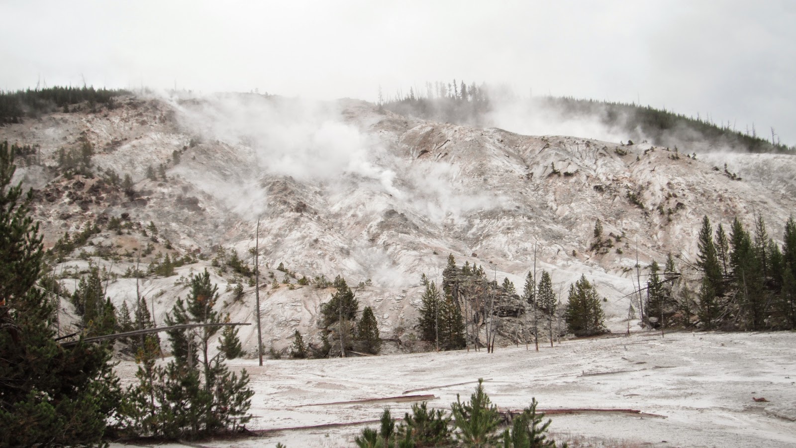
Our first stop of the day was at Roaring Mountain named for the sound of the hiss of steam escaping from the mountain. This barren, inhospitable slope has billions of hydrogen sulfide eaten thermophiles (microscopic organisms) that convert the gases to sulfuric acid which breaks down the volcanic rock acceleration erosion.  Right after leaving Roaring Mountain, we saw a lone bison up on a hill.


Roaring Mountain
The drive from the Yellowstone Plateau down to Mammoth Hot Springs drops through the Golden Gate named for the light colored volcanic rock. We stopped to take photos of the bridge hanging from the canyon wall and the views of the cliffs and distant mountains. On the way down we went through and area of odd shaped white rocks unlike anything we had seen which looked really out of place in their surroundings.


Starting Down Through the Golden Gate

Hanging Bridge
Strange Rocks


We had heard a lot and seen the evidence of the fires of 1988. An interpretive sign along the way explained that it wasn't just one fire but fifty fires that burned that summer with over twenty-five thousand firefighters working to control them. The first fire started on May 24 and fires continued to smolder into November even though the first snow fell on September 11. It was the driest summer in a hundred twelve years of weather statistics and hurricane force winds and much lightening without rain only made conditions worse. While at the overlook where the interpretive sign was, we saw about a dozen elk on nearby hillsides.


There are Several Elk in This Photo


Reaching Mammoth Hot Springs, we turned into Upper Terrace Drive. We managed to squeak into a parking space and got out to walk the maze of boardwalks to view the landscape. Unlike the geysers that we had seen in other areas of the park, the water rising to the surface here brings up calcium Carbonate that hardens to form travertine terraces. The layers of travertine are constantly changing, some becoming dormant and others forming new formations. The different microorganisms again gave the formations their different colors. From the boardwalks we could look down at the settlement of Mammoth which had been and army base in the late 1800s and early 1900s.


As the Springs Flow Out It Kills the Trees

Canary Springs
Travertine Layers

The Settlement Below

Ted Likes the New Jacket, Peaches


Maze of Boardwalks
Cleopatra Terrace


More Boardwalks


When we had walked most of the boardwalks we continued the mile and a half Upper Terrace Drive seeing more dormant and active formations before driving down to the village (elevation 6239') where we had a picnic. While at the picnic table, we saw a couple of elk on the lawn of a house where a moving van was being loaded. After lunch we explored the lower terraces and then drove to the visitors center. Several more elk were feeding on the bright green grass in the middle of the village with rangers on duty to keep tourists away from them.


Dormant Terrace

Spitting From the Top
Orange Spring Mound
Angel Terrace
Lunch Time
Two Elk and a Moving Van
Ted and Sheila in Front of Liberty Cap
Lower Terraces


Elk On Lawn


We drove north down a winding road through a canyon formed by the Gardiner River to the town of Gardiner and out through the Roosevelt Gate. We got photos of the gate and reentered the park driving back up the winding road to Mammoth. 


From the village we took the road west to Tower-Roosevelt. The northern pains of the park are covered in sagebrush and erratic rocks from long gone glaciers. We stopped to view the Undine Falls and then stopped to walk the boardwalk trails of Forces of the Northern Range, a self-guiding tour describing the flora and fauna as well as fire and weather of the northern range of Yellowstone.


Undine Falls


Instead of staying on the main drive, we decided to take the six mile dirt road Blacktail Plateau Drive thinking we would see more wildlife. It was a beautiful, if rough, drive but we only saw one hawk and one pronghorn. At the end of the drive we took the short road to see the petrified tree. We didn't walk up to the tree which, unlike other petrified trees we have seen, is still vertical.


Hawk

Pronghorn

Petrified Tree
Just after Tower, we headed south and stopped at Calcite Springs, a hydrothermal area on the Yellowstone River. Past volcanic activity caused interesting formations that looked like vertical fence posts all along the cliffs of the Yellowstone with unusual blue-green stripes in the cliffs as well. There was an area along the roadside that had the same strange vertical formations that we could see across the river on the cliffs.


Calcite Springs


Vertical Lava Flow

Blue-green Stripe
Yellowstone River and More Formations

Formations Up Close
We stopped at Tower Falls for a photo op and went in to the gift shop for an ice cream.  One of the managers gave me a volunteer application after I had chatted with him awhile.  I also chatted with a guy from New Hampshire and one from Maine.  We were having our own little New England convention at the ice cream window.


Tower Fall on Tower Creek Flowing into Yellowstone River
From there we went up over the Dunraven Pass with an elevation of 8859 feet, the highest pass in the park. There were beautiful view but the one picture Ted wanted me to take was of the highest pit toilet in Yellowstone National Park. Go figure.


Highest Pit Toilet
The ride to Canyon Village, Norris and Madison was pretty uneventful. Along the Madison River we saw a female elk and calf lying beside the water and a big bull elk wading across the river and causing a big traffic jam.


Elk Traffic Jam
Once through West Yellowstone we started seeing big streaks of lightening and it started pouring once we turned onto Rainbow Point Road. We were on the partially flooded dirt road when Ted asked if it had snowed. The side of the road was all white from snow or hail and there was white in the road as well. We arrived back at the campground a little after six having driven almost exactly one hundred fifty miles today.


Is This August?!?
On the Road As Well