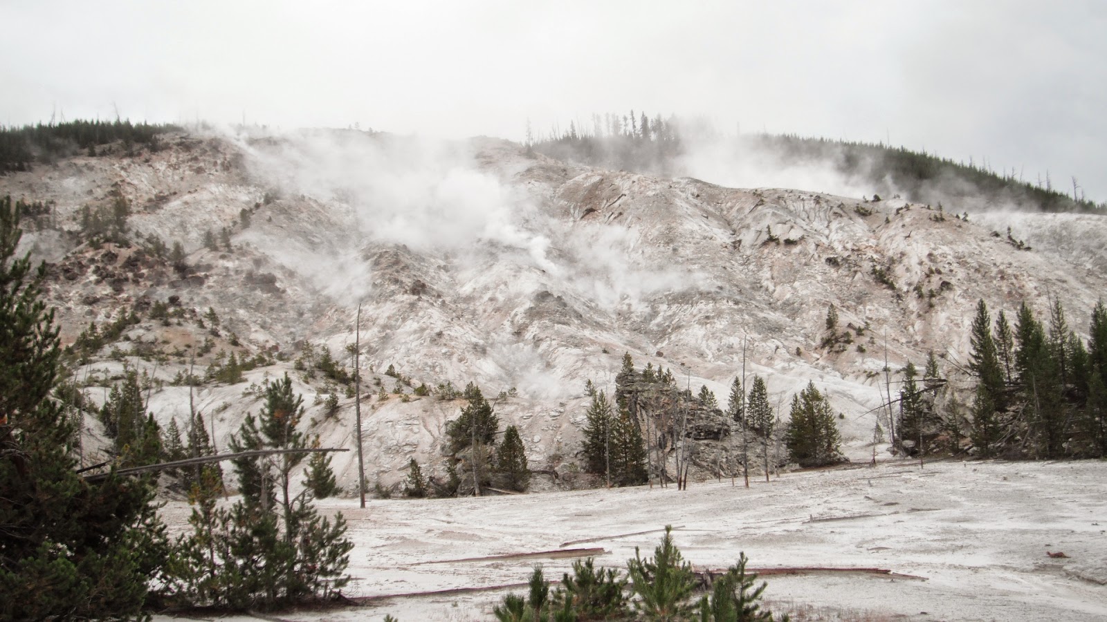
Mammoth Hot Springs was our destination today. It was overcast and cold and once in the park difficult at times to tell what were low hanging clouds and what were steam vents. Since we had driven the road before, we didn't stop until after we passed Norris. We did see three or four elk on our way. There is road construction between Norris and Mammoth and we had to wait about twenty minutes to get through. They are widening the road and in places even rerouting it.
 |
| Steam and Clouds Combine |
 |
| Low Hanging Clouds |
 |
| Which Is It? |
 |
| Waiting to Get Through Construction |
 |
| Men at Work |
Our first stop of the day was at Roaring Mountain named for the sound of the hiss of steam escaping from the mountain. This barren, inhospitable slope has billions of hydrogen sulfide eaten thermophiles (microscopic organisms) that convert the gases to sulfuric acid which breaks down the volcanic rock acceleration erosion. Right after leaving Roaring Mountain, we saw a lone bison up on a hill.
 |
| Roaring Mountain |
 |
| Starting Down Through the Golden Gate |
 |
| Hanging Bridge |
 |
| Strange Rocks |
We had heard a lot and seen the evidence of the fires of 1988. An interpretive sign along the way explained that it wasn't just one fire but fifty fires that burned that summer with over twenty-five thousand firefighters working to control them. The first fire started on May 24 and fires continued to smolder into November even though the first snow fell on September 11. It was the driest summer in a hundred twelve years of weather statistics and hurricane force winds and much lightening without rain only made conditions worse. While at the overlook where the interpretive sign was, we saw about a dozen elk on nearby hillsides.
 |
| There are Several Elk in This Photo |
Reaching Mammoth Hot Springs, we turned into Upper Terrace Drive. We managed to squeak into a parking space and got out to walk the maze of boardwalks to view the landscape. Unlike the geysers that we had seen in other areas of the park, the water rising to the surface here brings up calcium Carbonate that hardens to form travertine terraces. The layers of travertine are constantly changing, some becoming dormant and others forming new formations. The different microorganisms again gave the formations their different colors. From the boardwalks we could look down at the settlement of Mammoth which had been and army base in the late 1800s and early 1900s.
 |
| As the Springs Flow Out It Kills the Trees |
 |
| Canary Springs |
 |
| Travertine Layers |
 |
| The Settlement Below |
 |
| Ted Likes the New Jacket, Peaches |
 |
| Maze of Boardwalks |
 |
| Cleopatra Terrace |
 |
| More Boardwalks |
When we had walked most of the boardwalks we continued the mile and a half Upper Terrace Drive seeing more dormant and active formations before driving down to the village (elevation 6239') where we had a picnic. While at the picnic table, we saw a couple of elk on the lawn of a house where a moving van was being loaded. After lunch we explored the lower terraces and then drove to the visitors center. Several more elk were feeding on the bright green grass in the middle of the village with rangers on duty to keep tourists away from them.
 |
| Dormant Terrace |
 |
| Spitting From the Top |
 |
| Orange Spring Mound |
 |
| Angel Terrace |
 |
| Lunch Time |
 |
| Two Elk and a Moving Van |
 |
| Ted and Sheila in Front of Liberty Cap |
 |
| Lower Terraces |
 |
| Elk On Lawn |
We drove north down a winding road through a canyon formed by the Gardiner River to the town of Gardiner and out through the Roosevelt Gate. We got photos of the gate and reentered the park driving back up the winding road to Mammoth.
From the village we took the road west to Tower-Roosevelt. The northern pains of the park are covered in sagebrush and erratic rocks from long gone glaciers. We stopped to view the Undine Falls and then stopped to walk the boardwalk trails of Forces of the Northern Range, a self-guiding tour describing the flora and fauna as well as fire and weather of the northern range of Yellowstone.
 |
| Undine Falls |
Instead of staying on the main drive, we decided to take the six mile dirt road Blacktail Plateau Drive thinking we would see more wildlife. It was a beautiful, if rough, drive but we only saw one hawk and one pronghorn. At the end of the drive we took the short road to see the petrified tree. We didn't walk up to the tree which, unlike other petrified trees we have seen, is still vertical.
 |
| Hawk |
 |
| Pronghorn |
 |
| Petrified Tree |
 |
| Calcite Springs |
 |
| Vertical Lava Flow |
 |
| Blue-green Stripe |
 |
| Yellowstone River and More Formations |
 |
| Formations Up Close |
 |
| Tower Fall on Tower Creek Flowing into Yellowstone River |
 |
| Highest Pit Toilet |
 |
| Elk Traffic Jam |
 |
| Is This August?!? |
 |
| On the Road As Well |


No comments:
Post a Comment