October 10, 2014
It was another rainy, cold day so we mostly stayed in. The one excitement of the day was when Ted went out to barbecue at dinner time. On the railroad tie near the front passenger tire of the motorhome was a tarantula. I leaned out the side window in the rain and got a picture of it. Evidently, if you are from this area it is no big deal to see these huge spiders but seeing one in person in the wild for the first time was something else. Ted decided he would take the long route around the motorhome to get to the grill on the other side.
 |
| Furry Critter |
October 11, 2014
Ted got me out of bed early this morning to see the mass of hot air balloons on the horizon. This is the last weekend of the Albuquerque Balloon Fiesta that we went to two years ago. We are about forty miles from Albuquerque and the balloons were coming toward us. We needed binoculars to barely make out the shapes and colors of the balloons but early on I counted about seventy-five and we estimated twice that many before it was done. We talked to a couple later in the day that said five hundred fifty balloons went up from the fiesta grounds. It was fun to watch from a distance and we didn't have to fight the traffic either.
 |
| Balloons on the Horizon |
We left mid morning to go to Bandelier National Monument. The not very good map that we have of New Mexico showed a road on the other side of the lake that would take us there on a much shorter road than the eighty miles to go back through Santa Fe. Once past the town of Cochiti Lake, we drove a few miles and the road was blocked and closed by the Cochiti Indian Reservation with signs saying anyone proceeding would go to jail. A little further back there was a seventeen mile narrow, dirt road that would take us toward the national monument but we opted out of that.
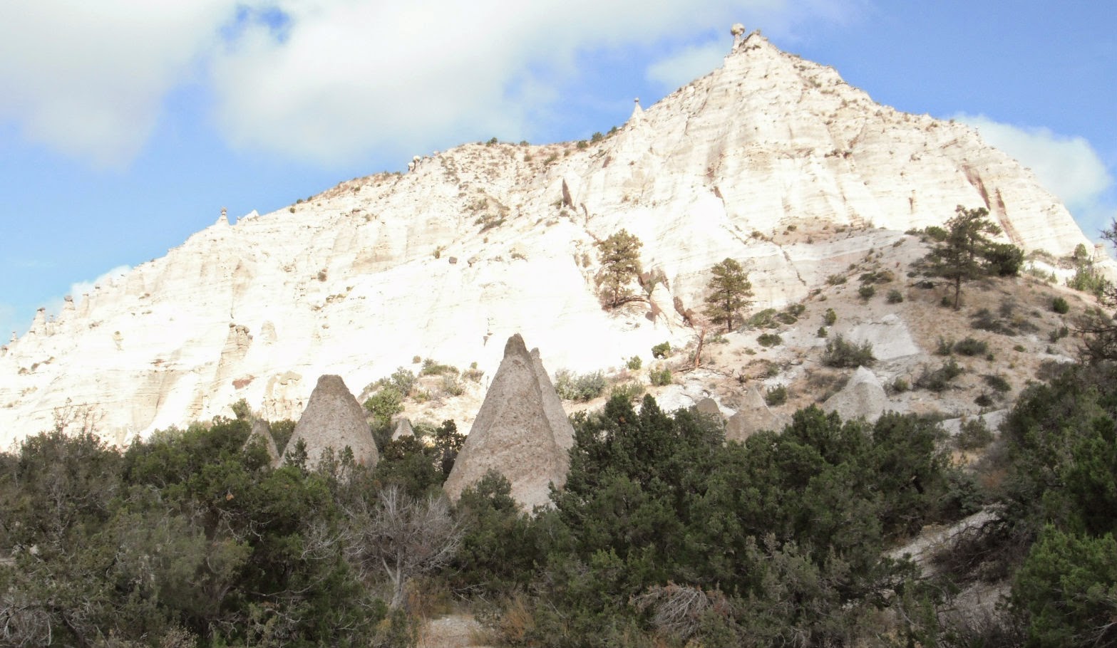
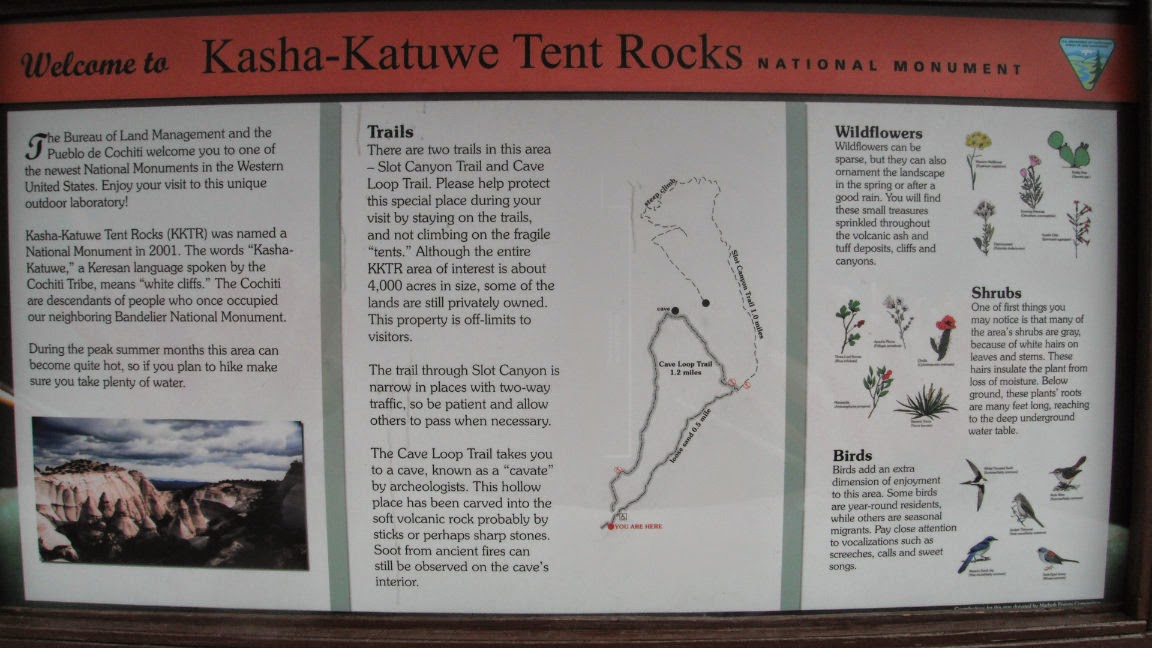
We had passed a turn to Kasha-Katuwe Tent Rocks National Monument so we decided to go there instead. This national monument, one of the newest in the BLM system, was established in 2001 by President Bill Clinton and you have to cross the Cochiti Indian Reservation to get to the parking lot and trailheads. After going through the entrance gate, the eight mile road has many "dips" in it that allow rain runoff to go across the road without washing it out and without the need of expensive culverts and bridges that are only needed a couple of times a year. We found a parking spot and started out on the mile and a half long trail that goes through a narrow slot canyon around a large hill and then up along switchbacks leading to the top of the mesa. In the mile and a half, the trail rises six hundred forty feet.
 |
| Entrance Gate |
 |
| Starting Up |
 |
| Kasha Katuwe Means White Cliffs |
The slot canyon was really neat with colored layers of volcanic rock and ash. The ground was mostly soft sand with some narrow passages through the rock that were only a foot's width wide at the bottom but wider as the rocks went up so there was not concern of getting stuck. There was some climbing of rocks within the canyon but the real climb didn't begin until we were around the hill and through the canyon. There were many "tents" which are cones of soft pumice and tuff created by volcanic action beneath harder cap rocks. Erosion had shaped the canyon into beautiful and interesting shapes.
The climb to the top had only one place that was quite difficult and also quite scary. The spectacular scenery helped allay my fear of heights. We stopped at one point to take pictures where an artist was sketching the striated cliff rocks and the tents that were now below us. On the way back, he was filling in the colors and had made quite a lot of progress in the less than an hour we had been gone. When we got to the top, we had a three hundred sixty degree view of the mountains and hills around us. We could see Cochiti Lake and think we saw where the motorhome was sitting on the other side of the lake. We sat on the ground at the end of the path with drop offs to the valley below all around us and ate a snack.
 |
| Sketching Big Crayons |
 |
| We Took Many Photos of this View |
 |
| Getting Close to the Top |
 |
| Highest Point of the Trail |
 |
| Down to the Overlook |
 |
| Looking Into the Side We Did Not Hike |
Because the trail was narrow, we often stopped to let people through or they would stop to let us pass. Once back in the canyon, we were waiting for people when I saw a woman admiring a shrub beside the trail. I asked if she knew what it was and she said she didn't. I remembered I had a pamphlet on plants in my backpack and we decided it was a Manzanita. Her husband said that means something or other and I said "I don't know, we are from Maine and we learn French there". They said they were from Maine as well. Another small world situation. We walked the rest of the way back to the parking lot with them chatting about Maine and other National Parks we have visited.
It was a wonderful three mile hike and I am so glad we got to hike there. The cold temperatures of the morning gave way to just cool enough weather to hike in. The sun was mostly out and it was just a beautiful day. To top it all off, we enjoyed a beautiful sunset.


No comments:
Post a Comment