We woke up to a dark, gray day. Ted went out early and discretely washed the motorhome as he was told he could do. By mid morning when we were ready to go into the national park, it was lightly raining and it rained off and on until sometime mid afternoon.
 |
| View Out Our Front Window |
 |
| On Our Way to the Park |
The first stop before we were into the park was the Canada Welcome and Information Center. As we walked in we were met by the huge skeleton of a Tyrannosaurus Rex. We talked with the women working the information desk and got brochures, maps and other information that will be of use to us when we get to Canada. One of the young ladies grew up in New Brunswick not far from Presque Isle. The center had nice displays depicting what to see and do in Alberta so we wandered around awhile before leaving.
 |
| Canadian Welcome Center |
 |
| T-Rex |
We entered Glacier National Park in the rain and fog and proceeded to the visitors' center to get my park passport stamped. One of the reasons to come to this park is to drive the Going-to-the-Sun Road which crosses the continental divide to reach the eastern entrance to the park. Unfortunately, the road is only open on the western side for sixteen miles and on the eastern side for only a half mile. I suspected because we are so early in the season that we may not be able to reach the summit but expected a little more to be open. The visitors' center near the entrance is small with no exhibits or film. All that is at the summit which of course we will not see. We got a little more info and I stood under my umbrella to take some pictures of interpretive signs which will help us explore what is available.
 |
| The Road is Open to Just Beyond the Lake |
 |
| We Only Get to See the Top Row and Two on the Bottom |
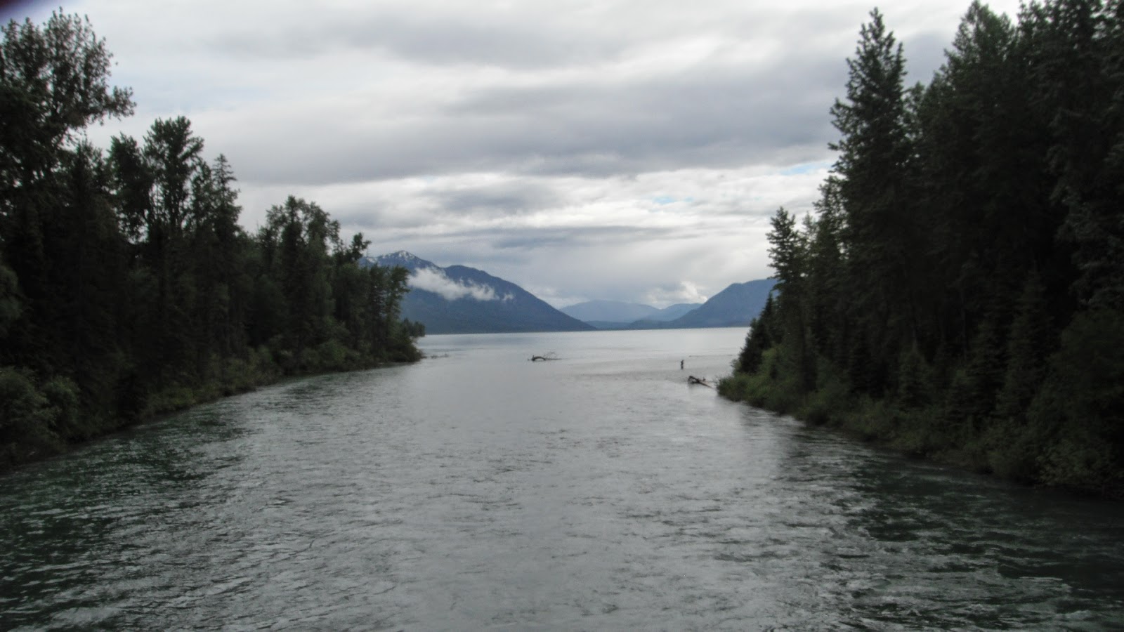
We traveled the roads around the Apgar Visitors' Center and Apgar Campground stopping at a couple of picnic areas near the southern end of Lake McDonald. One road we explored turned into a really narrow dirt track and we had a hairy time turning around to return. We drove to Fish Creek Campground looking to see if we could have fit into any of the sites. They gave us a map and we drove around circling the site we potentially could use. Again we stopped to look at a the fog covered lake. We started up the road towards Polebridge but decided to wait until a nicer day when we could launch our boats on Bowman Lake. The area on the west side of Lake McDonald had experienced a forest fire in 2003 and the trees were just tall poles with new growth underneath. Since it was raining and we were hungry, we decided to just return to the campground.
 |
| Ted in the Cold and Rain at Lake McDonald |
 |
| Road Got Narrower After This |
 |
| South End of Lake McDonald |
Late in the afternoon, it started to clear up with the sun occasionally peaking out so we decided to drive back into the park which only about a mile from where we are staying. We stopped at a few turnouts to take pictures but since most of them were on the opposite side of the road, we decided to stop on our return trip. We did stop at Sprague Creek Campground and found a good place to launch our kayaks. Along the way we were looking up at huge cloud covered cliffs that had waterfalls flowing from top to bottom. Despite the gray weather, it was amazing to see.
The end of the sixteen miles that are open was where the wheelchair accessible, .8 mile Trail of the Cedars nature trail was. We walked out on the gravel bar at the edge of the McDonald River where the Avalanche Creek flows in and then returned to the trail.
 |
| It is Hard to Show the Scope of the Size of the Mountains |
 |
| Waterfall all the Way |
 |
| Avalanche Creek on Right Meets McDonald River |
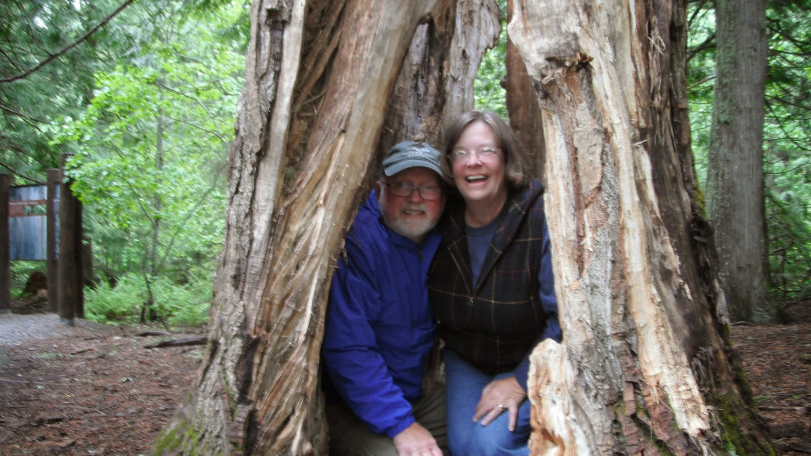
The trail is a boardwalk that crosses Avalanche Creek and follows the creek until it reaches the Avalanche Campground and becomes paved. The damp walk took us through a forest of huge Western Red Cedars, Black Cottonwoods, and Western Hemlocks, some of which were as big as eight feet in diameter at their base. One brook that flowed into the river had a beautiful waterfall that had sculpted the rocks into amazing shapes. There were a couple of hollow tree stumps along the way. I got in one for Ted to take my picture and some guy came along and said we should both get in. We did and he took our picture.
On our way back to the entrance, we stopped at several places along the way to take photos of the spectacular waterfalls. This early in the spring, the snowmelt is still rushing down from the mountains making powerful, awe inspiring waterfalls and rapids rushing towards Lake McDonald. It was not a place we would like to put in a boat of any kind but very beautiful just the same.
 |
| Sacred Dancing Cascade |
 |
| Sacred Dancing Cascade |
 |
| More CCC Work |
At one of the stops, we saw one of the park's famous red busses whose driver just happened to be the gentleman who took our picture. The fleet of busses (I later counted sixteen including the one at the falls) were built in the 1930s and have been restored and updated with clean, efficient propane engines. When the Going-to-the-Sun Road is open, they transport guests up and over the continental divide. The canvas tops roll back to make them open air and convenient for taking pictures of the high cliffs overhead.
Down near where the river enters the lake there is another set of falls and a one lane bridge that we took toward the Trout Creek Trail. Again it was just a narrow dirt track beside the lake but on the west side where the forest fire had been. We managed to turn around and stopped to take some pictures at the bridge.
 |
| Beautiful View Across Lake |
 |
| Remains of Forest Fire |
 |
| Lake McDonald From West Side |
 |
| McDonald Falls |
 |
| Where the River Meets the Lake |
We stopped to take a picture at Lake McDonald Lodge. It is in that area of the lodge, cabins and general store that all the red busses are parked. After that, it was time to return to the campground.
 |
| Lake McDonald Lodge |


No comments:
Post a Comment