Friday, May 30, 2014

Theodore Roosevelt National Park, Day 2

Theodore Roosevelt, our 26th president, first came to North Dakota badlands to hunt in 1883. Before returning east he bought a partnership in a ranch and the next year returned to set up his own ranch.  He hired two woodsmen from Maine to run his ranch while he returned east.  After his wife and mother both died on the same day in the same house, one from childbirth and the other from typhoid, he returned to North Dakota Territory to grieve and heal.  While spending time here, he became alarmed by the damage that was being done to the land and its wildlife.  He became a conservationist and no president has done more for conservation than Theodore Roosevelt.  During his presidency he set aside over 230 million acres of federal land for conservation, an area larger than the state of Texas.  He established 150 National Forests, 25 National Parks and Monuments, 51 Federal Bird Reservations, 4 National Game Reserves and 24 Reclamation Projects.  After his death the Theodore Roosevelt National Memorial Park, later National Park, was set aside to honor his conservation legacy.

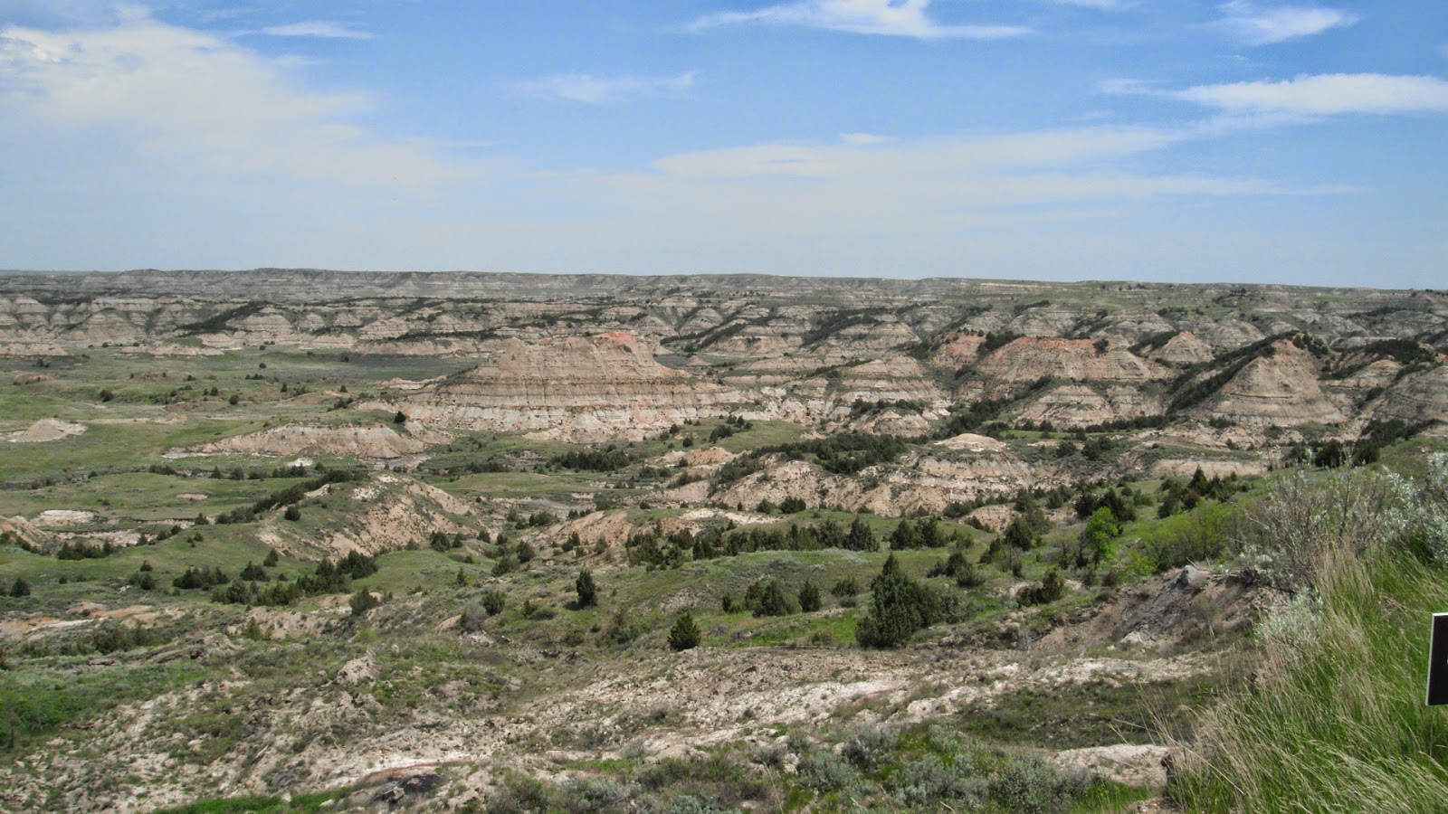
Typical Badlands Feature
After packing our daypacks, we started out about 8:30 hoping to get some hiking in before it got too hot.  The park loop is thirty six miles long with some side roads off from it and several hiking trails.  One of the first places we stopped was at a prairie dog village of which there are several around the park.  In large fields there are hundreds of holes where the prairie dogs live.  We sat and watched four babies about six inches long wrestling and playing.  They are so cute.  The larger prairie dogs sit upright at the entrance to their burrows and chatter at us to go away.

Four Baby Prairie Dogs
We stopped at Scoria Point Overlook next.  Where coal seams have caught fire and baked the surrounding sand and clay, the results like a natural brick is called scoria.  Over the years erosion has removed the softer earth and left the bluffs capped with this colorful, harder and more resistant  material.


We parked the car and started up the Ridgeline Trail.  The trail is very steep to start off with and we were both feeling our legs but once we reached the plateau, it was a lovely walk across a meadow and then out to a point for a panoramic view of the area.  We finally saw wildflowers and the view was stunning from I-94 to the south all the way around and back again.  We sat and just drank in the beauty, smell of sage and sounds of birds for at least twenty minutes before the .6 mile trek back to the car.  

Wildflowers with Badlands in the Distance

Ted Approaching Narrow Part of the Trail
The Badlands Continue for Miles


We saw some wild horses along the way and at North Dakota Badlands Overlook we could look across Paddock Creek to see fields of bumps where erosion has worn away all but the hardest materials.
Wild Horses

Paddock Creek
The next hike was the .8 mile Coal Vein Trail.  For over twenty-five years, from 1951 to 1977 a coal vein burned in this area.  When the fire had finally burned itself out, it left spaces underground where the coal had been.  The earth sank to fill the space causing "slumps" or depressions in the land.  Also, as at Scoria, there was bright colored brick-like rocks and brittle pieces of baked clay.  As we walked through this area, we could see deep gullies where the ground had sunk and whole sides of hills that were broken off.

Baked Earth
Area Where Earth has Fallen Away
More Pretty Wildfloweres
Another steep but short climb took us to the top of Buck Hill.  From there, we finally saw some bison.  There were only five and far away but we had remembered the binoculars so we could see them and five was better than none.   The zoom on my small camera is better than I thought and we can at least recognize that they are bison.  We had another three hundred sixty degree view of the spectacular landscape.

Click on the Picture to See the Bison
Ted With a Great View
Top of Buck Hill


The next twelve miles were more of the same beautiful landscape only with much more grassland with the road winding among the eroded peaks.  There was a section of a few miles on the left hand side of the road that looked like it had been burned but the grass was really green and healthy looking.  We later found out that they had done a prescribed burn just three weeks ago.  It is amazing how fast everything comes back.

Prescribed Burn
Wind Canyon Trail is just a short trail but takes you up where you look down on an oxbow of the Little Missouri River.  The prevailing winds pick up the sand from the riverbed and blow it into the northwest facing canyon, sandblasting the rock into smooth, strange shapes.  On the opposite side of the river there were three groups of bison, probably sixty to seventy in all.  Again, they weren't close enough to photograph well but we know they are there in the pictures we have.

Little Missouri River
Sandblasted Sides of Wind Canyon
Herd of Bison on the Plateau
It was eleven miles back to the park entrance and the visitors' center.  The cabin that Roosevelt had lived in on his first ranch has been moved behind the visitors' center.  We went out and looked at the humble log cabin before going in to watch the twenty minute film.  After a look around the museum, we had had enough for the day and drove in to the tiny town of Medora for some beer and milk.  I got Bent Nail IPA from a Montana Brewery and Ted got Fat Tire Amber Ale from Colorado.  It sure tasted good when we got back to the motor home.

Roosevelt's Maltese Cross Cabin

Roosevelt and Horse Made of Narrow Wooden Strips

Thursday, May 29, 2014

Theodore Roosevelt National Park

Wind!!!  All night long and all day, too.  We left Lake Sakakawea State Park this morning and the wind was gusting up to forty miles per hour out of the southeast.  The roads run due north/south or east/west so no matter which direction we were going they affected us.  The roads have no shoulders and no guardrails so when a gust hits the broad side of a motor home and sets it over a foot or so, it can get pretty scary.  I couldn't watch and hemmed the dress I made the other day.  Ted obviously had to drive slower than normal and quite a parade behind him by the time we got to I-94.  There were places that people could have passed but the wind was probably affecting them as well.

Oil Well off I-94
Art Along I-94
The wind lessened or at least didn't affect us as much on the interstate and we safely arrived at the Painted Canyon section of Theodore Roosevelt National Park a little after noon...or maybe a little after eleven.   Our phones and computers are set to change automatically but I'm not sure they did and I'm not sure which device we checked the time on not that it matters.  This section of the park is just off I-94 and is a rest area as well as park.  As we were driving in we saw three or four bison in the distance but not close enough to get any photos.  We had a slice of leftover pizza and went in to check the visitors' center out and get our park passport stamped. 

I talked Ted into buying a new t-shirt.  It is Advice from a Bison:  Stand your ground.  Have a tough hide.  Keep moving on.  Cherish wide open spaces.  Have a strong spirit.  Roam wild and free.  Let the chips fall where they may!  I think Ted follows that advice pretty closely...except maybe for the chips falling.  We went for a hike and boy, what huge chips there were.


The park is mostly badlands. Sixty million years ago streams carried eroded material from the Rocky Mountains and deposited it on a vast lowland in layers.  Even as it was being deposited, streams were cutting down through the soft strata and to sculpt an infinite variety of buttes, tablelands and valleys.  They are defined as a type of dry terrain where softer sedimentary rocks and clay-rich soils have been extensively eroded by wind and water.

Badlands from Visitors' Center
We walked the paths around the visitors' center and then took the Painted Canyon trail down into the badlands to see them up close and personal.  Although dry, there was plenty of vegetation including some cacti, sagebrush, cottonwood trees and cedar trees.  The path was steep in places so we had to watch our footing but the scenery was spectacular.  When we reached the bottom and walked around one of the buttes, we were surprised at how far above us the visitors' center was.  Note to selves... even if the trail is only a mile long, take water.  We are so out of the habit of hiking on anything that wasn't flat or humid that we forgot what it was like to be out in this kind of terrain in the dry heat of the noon day sun.  We managed fine but were really thirsty by the time we got back to the motor home.


We got back on I-94 and drove the few miles west to get into Medora, ND and the entrance to the South Unit of the Park.  The park road rose quickly so we were looking down of I-94 and after crossing over the highway climbed to the top of a butte where we found a prairie dog town.  We saw dozens of prairie dogs sitting beside their holes, some playing but most just on the lookout.  There were probably hundreds of holes.  

Prairie Dog Town
After waiting in line to get through construction, we arrived at Cottonwood Campground.  We rode around the pull through loop seeing several potential sites nearer the Little Missouri River but settled on one away from the water.  Even though it was quite hot, there was a nice breeze and we opened all the windows and sat and listened to the birds.  As in most national parks, there is no water, sewer or electricity so we will be roughing it for a few days.  Ha!  With the generator on for a short time to nuke our leftovers and charge our electronics, there is no need for sympathy for us.

Wednesday, May 28, 2014

Kayaking, Storm, Walking and Fish Hatchery

The water was like glass when we got up this morning.  Ted wanted to go kayaking but I had four loads of laundry that needed doing before we spent the next few days without electricity at national parks.  I started a load and was sitting in my chair doing something on my computer when I noticed him out of the corner of my eye.  I grabbed my camera just as he called me on my phone.  I went out to take his picture down on the water and my battery was dying.  I tried to take some pictures and came back in to get a battery I had just charged.  That one was dead as well.  


I did manage to get a photo and he took some looking up at the motor home.
  

He also took a great picture of some goose eggs laying on the ground as well as a few other great photos.


No sooner did he get back than the sky got ominously dark and it started to sprinkle.  I went on line to check out The Weather Channel.  They had a warning of 45 mph winds and severe thunderstorms until 6:00 p.m. Ted tied the kayaks down to the picnic table and laid the bikes down while I put the slides and awning in and grabbed some food and our computers in case we had to wait it out in the park bathroom facilities.  There would have been plenty of room as there are over a hundred fifty sites and probably fewer than a dozen RVs in the whole campground.  It was raining hard and we decided to drive to the visitors' center.  When we arrived there, we were told that they had just checked the radar and the storm would be over in about a half hour.  We chatted with the person at the counter and with another couple who were just pulling in and wanted to wait to set up until after the storm had passed.  They were from the Bismarck area and spend their winters in Mesa near Phoenix.  We have met other people who winter there and will look into that area when we get to Arizona.

The storm did pass and we returned to the RV and opened back up.  I continued doing laundry and after lunch the sun came out, it warmed up and we went for a long walk around the campground.  Down by the shore, the rocks look like small pieces of red shale.  It is very brittle and almost looks like brick.  


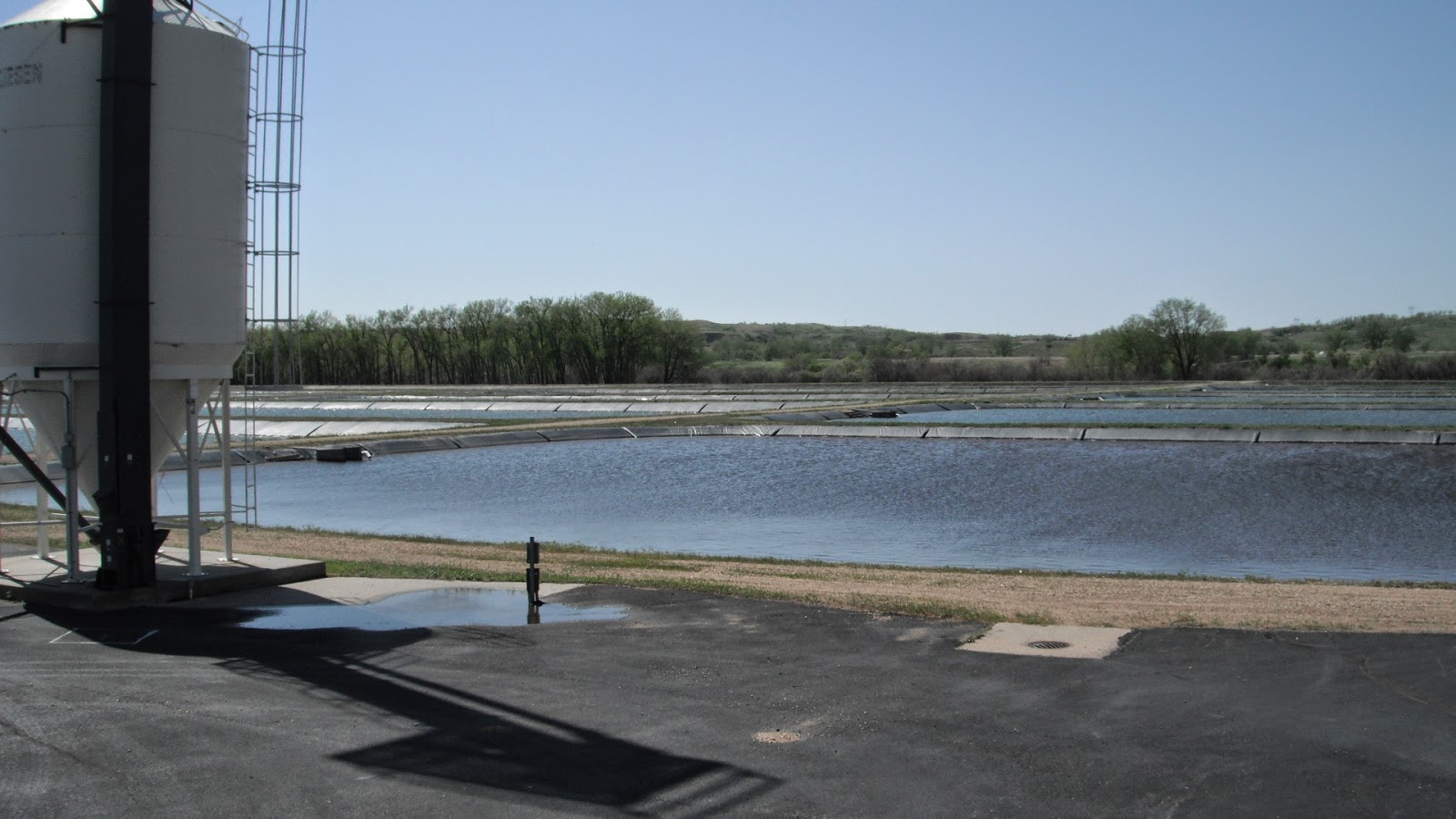
When we returned to our site, we drove to the Garrison Dam National Fish Hatchery.  We had both noticed these squared off ponds below the dam and thought they were a waste water treatment facility.  There are sixty four acre and a half ponds for the propagation of fish.  The self guided tour started in one building where the egg incubators were.  They incubate northern pike, walleye, paddlefish and sturgeon.  A quart of northern pike contains 60,000 eggs while a quart of walleye contains 120,000 eggs.  As fish develop, they are transferred to various other tanks or ponds which we were able to view.  We saw some unusual, endangered fish in some of the tanks.  The paddlefish, a filter feeder, is a prehistoric fish that lives for about thirty years and grows to be a hundred pounds.  In the Sturgeon Building, we saw sturgeon that were at least five feet long.  In the salmon building there were tanks with hundreds, maybe thousands of rainbow trout.  Automatic feeders are hung overhead and when the food drops, the fish look like one black blob on the side of the tank where the food is.  It was amazing to watch.


We drove to the Under the Dam Campgrounds which lie along the Missouri River at the outlet to the dam to check it out.  I have heard horror stories of campers being washed out by flash floods and dams letting go so there is no way we will ever stay at a campground that is on the down side of a dam.

When we returned, I made pizza dough and we had a loaded pesto pizza for dinner.  Thanks kp for the homemade pesto.  It is yummy.  While we watched a movie I asked Ted where the Mountain Time Zone began and upon looking it up, it runs right down the middle of the water we were looking at.  The line zigzags down through North Dakota and we were just into it.  Our phones and computer weren't aware of it, though.  We must be getting our signal from across the water.


Tuesday, May 27, 2014

Knife River Indian Villages and Lewis and Clark Trail

After a beautiful sunset from beneath the clouds, we had a terrific thunderstorm in the night.  Once the rain eased, we had one of the worst wind storms I have seen or rather heard.  Sitting high on a bluff, there was little protection from the wind.  It was difficult sleeping but when we finally woke up, the lake was flat calm and has remained so.


Our first stop of the day was the other end of the dam for a couple of pictures and then on to Knife River Indian Villages National Historic Site.  Sixteen hundred miles up the Missouri River, Lewis and Clark spent their first winter across the river from this site.  We went into the visitors' center and the ranger there was very enthusiastic, talking our ears off.  I think it hasn't been busy and she was just so happy to have someone to talk to.  We watched the short film which was in the words of one of the female Mandan Indians who had lived into the early twentieth century and could recall what life was like in the villages and would have been like when Lewis and Clark were there in the winter of 1804-05.  

After looking through the interpretive material in the center we went out to look at the replica of an earthlodge, the type of home the Mandan and Hidatsa Indians lived in.  With an inside structure of logs, the frame was covered with dirt.  Each earthlodge was thirty to sixty feet in diameter and housed up to twenty people.  We were able to go into the lodge whose doorway was covered with a buffalo skin.  The inside was set up as it would have been with the fire pit in the center and beds around the perimeter.  They were an agrarian society and there were dried vegetables hanging from the wooden supports overhead.


The villages were set up with these lodges close together with only enough space for their drying racks and a path to walk between.  When the lodges disintegrated over time, the dirt slid down and left raised circles where they had once been.  We took the mile and a half walk out into the field to see the circles and depressions where two of the villages had been.     An artist had painted the village about thirty years after Lewis and Clark went through and stated that there were fifty-two lodges in the village that Sakakawea lived.  Due to river erosion and the shifting of the river channel, there are only thirty one depressions in the earth left. Since we were at ground level, it was very difficult to get photos that showed all these adjacent circles in the earth.


Now for Sakakawea or Sacagawea or Sacajawea as most of the world knows her.  She had been stolen from a Shoshone tribe at age twelve and lived in the second Mandan village that we walked to.  She was called Bird Woman and was probably given this name by the Mandans.  The Mandans have no "j" sound in their language and their "k" was more like a hard "g" so it is believed by the people in this area that her name was probably Sakakawea.  In Lewis and Clark's journals, they spelled her name eight different ways.  By the time their journals were translated three years later, Lewis had already passed away and Clark said he didn't know which spelling was correct so that left it to the interpreter to choose a spelling.  The North Dakotans vow he chose incorrectly.

For more earthlodge photos go to:  https://picasaweb.google.com/115859097710257188914/May272014KnifeRiverVillagesND?authkey=Gv1sRgCMrnsOez3bGohAE#

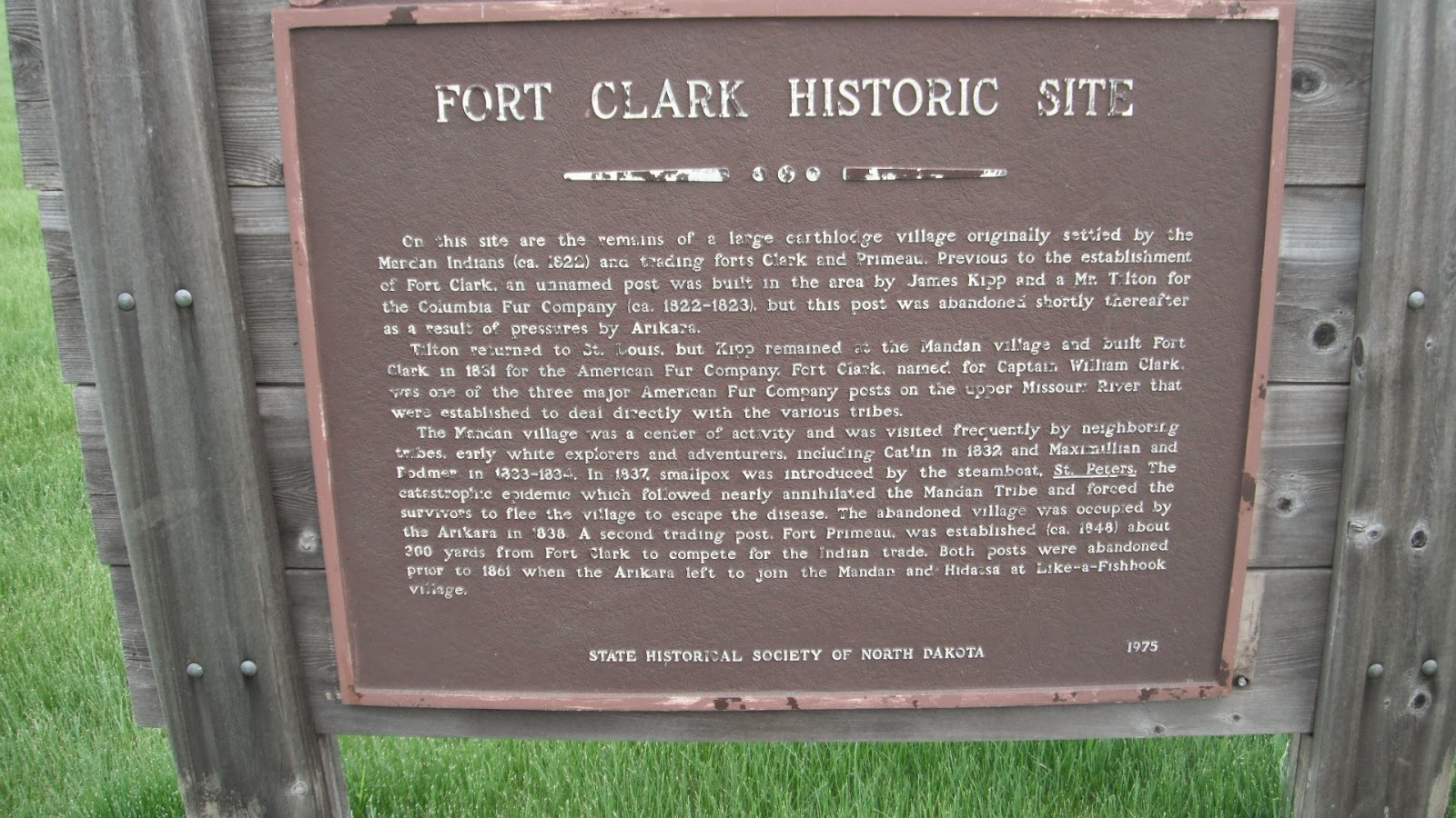
We drove to the Fort Clark State Historic Site but found only a field with more circle depressions so didn't walk the loop.  Fort Clark was one of three major fur-trading posts of the American Fur Company as well as a former site of a Mandan Village.  Lunch was at a family restaurant in Washburn.  Ted has Fleischkuchle, a German dish consisting of spicy fried ground meat encased in a flaky pastry served with french fries.  He said it was really good but neither of us could pronounce it and I had to note it on my phone to remember how to spell it.  


From lunch a short way up the road, we went to the Lewis and Clark Interpretive Center.  This museum is run by a non-profit business and was one of the best, if not the best displays of Lewis and Clark memorabilia that we have seen.  Besides the Lewis and Clark section, there were sections on Prince Maximillian of Weid and the artist Bodmer who retraced much of Lewis and Clark's path about thirty years after, the agrarian history of North Dakota, Fort Clark, and an art gallery with prints from George Catlin, another artist of the early 1800s.  Throughout the museum were exquisite bronzes of indians whose name I should have written down.  From the back porch of the museum we could look out at the Missouri River.


A few miles up the river was the replica of Fort Mandan where the Corps of Discovery had wintered across from the Mandan and Hidatsa villages.  Before visiting the fort, we walked to the river where there was a statue of a really big dog.  A little known fact, at least to us, was that Lewis had taken his Newfoundland, Seaman, along on the trip.  This little park area and statue was a memorial to Seaman.


This area of North Dakota is known for its coal mining and coal fired power plants.  The by-product of burning coal is called fly ash.  The company called Headwaters Resources is Americas largest manager and marketer of coal combustion products and produce building products such as FlexCrete, MagnaWall stucco and Eldorado stone.  The visitors' center at Fort Mandan, called Headwaters, is a totally "green" building made from these products.  The rocks on the outside of the building look totally real.  There wasn't much to see in the visitor's center so we walked out to the fort.


Though a replica, the fort was set up as it would have been in the early 1800s.  Each room had a purpose and different equipment or supplies which was explained by an interpretive guide who was very informative and very enthusiastic about his subject.  Again, he was probably glad just to have the company as it is still really early in the season.  By the time we were done listening to him, we were done.  Thirty miles or so back to the motor home and a glass of wine while looking out at the still flat lake.  Ahh.....